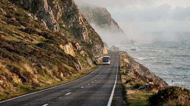
Cape Point and the Cape of Good Hope sit at the southwestern tip of the Cape Peninsula, inside a nature reserve of rugged fynbos, cliffs, and roaming wildlife that most visitors treat as the natural finale to a peninsula day. It’s a genuinely spectacular spot — a lighthouse perched on a cliff above crashing surf, a funicular railway up to it, and hiking trails through vegetation found almost nowhere else on Earth. It’s also the site of the most persistent myth on any Cape Town itinerary: this is not, as widely believed, the southernmost point of Africa, and it is not where the Atlantic and Indian Oceans officially meet. Both of those belong to Cape Agulhas, a few hundred kilometres further east. That doesn’t make Cape Point any less worth visiting — it makes it worth visiting for what it actually is.
| Where | Cape of Good Hope Nature Reserve, southern tip of the peninsula |
| Entry | Paid entry to the reserve; check current rates before you go |
| Time needed | Half a day; longer paired with Boulders Beach and Simon’s Town |
| Getting there | About an hour’s drive from the city centre |
| Best time | Morning, before wind picks up and crowds build |
The myth, and why it persists
Cape Point and the nearby Cape of Good Hope look like the end of the continent — the land narrows to a dramatic point, cliffs drop straight into the sea on both sides, and there’s a genuine sense of standing at the edge of something. That visual drama is almost certainly why the myth took hold: it feels like the southernmost tip of Africa, so for generations of visitors (and more than a few tour guides) it got treated as one. It isn’t.
Cape Agulhas, roughly 240km to the east along the coast, holds that title, and it’s also the officially recognised meeting point of the Atlantic and Indian Oceans — a distinction based on the oceanographic boundary, not a visible line in the water at either location. Cape Point is, more accurately, the point where the Atlantic’s cold Benguela current and warmer water start to mix noticeably, which is part of why the two coasts of the reserve genuinely feel different in water colour and temperature — a real and interesting phenomenon, just not the one most visitors think they’re seeing.
What’s actually here
The reserve covers a stretch of Cape fynbos — the fine-leaved, biodiverse vegetation unique to this part of South Africa — along with cliffs, beaches, and a resident population of chacma baboons, eland, bontebok, and ostrich that roam freely across the reserve. The old lighthouse, built in 1859 on the highest point, was eventually judged too often obscured by low cloud and sea mist to be useful for ships, and a second, lower lighthouse was built closer to sea level in the 1910s — both are still standing and worth the walk or funicular ride up.
Cape of Good Hope and penguins full-day tourA smaller-group option covers the same ground with more flexibility for photo stops and a slower pace through the reserve.
Cape of Good Hope small-group tour with penguinsGetting to the point itself
A funicular railway (locally called the Flying Dutchman) runs from the lower car park up to near the old lighthouse, saving a steep climb, though the final stretch to the lighthouse viewpoint is on foot regardless. Walking trails also connect the two lighthouse points and continue down towards Dias Beach, a smaller, more sheltered stretch of sand below the cliffs that most visitors miss entirely because it requires a proper walk to reach rather than a short stroll from the car park.
Cape Point tour from Cape TownFor the view that ties the whole reserve together — the point, both coastlines, and the wider peninsula in one frame — a helicopter flight covers ground that even a full day of walking can’t match.
Cape Point helicopter tourThe baboons
The reserve’s chacma baboon troops are wild, habituated to human presence, and genuinely capable of opening car doors and unzipped bags if given the chance — this is a real, well-documented issue here, not tourist folklore. Keep car windows closed and doors locked when baboons are nearby, never feed them (it’s illegal and it’s exactly what makes them bold enough to raid vehicles and picnics in the first place), and don’t make eye contact or approach for a photo. Signage throughout the reserve reinforces this, and reserve staff take it seriously.
Weather and the wind
The reserve sits fully exposed to the Atlantic and to the same south-easterly wind that shapes weather across the peninsula, so conditions here can be noticeably windier and cooler than in the city bowl on the same day — bring a windproof layer regardless of season. Cloud and mist can also roll in quickly, particularly in the cooler months, which is worth bearing in mind if photography of the point itself is the priority; a clear morning is the safer bet than a hazy afternoon.
Where the myth actually comes from
Part of the confusion traces back to the age of sail: early Portuguese and Dutch navigators rounding the Cape treated this stretch of coastline as the psychologically significant turning point on the route between Europe and the Indian Ocean trade routes, since it’s here that ships visibly change heading from south to east. That maritime significance is real and well documented — it’s simply a different claim from “southernmost point” or “meeting of the oceans,” and the two have blurred together in popular memory over centuries of retelling. Understanding that distinction doesn’t diminish the Cape’s genuine role in navigation history; if anything, it’s a more interesting story than the simplified version most guidebooks repeat.
How this fits into a peninsula day
Cape Point is almost always paired with Boulders Beach and Simon’s Town on the way there or back, and often with Chapman’s Peak Drive if approaching from Hout Bay — together they form the classic full-day Cape Peninsula loop that most first-time visitors do. Trying to see all of it in under half a day means rushing the reserve itself, which has enough trails and viewpoints to reward a slower pace if time allows.